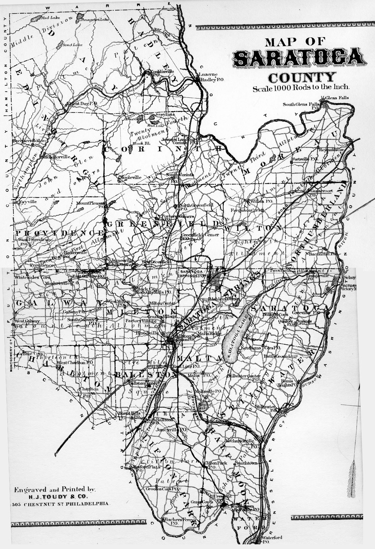
The map of Saratoga County is on the last page of the Atlas, page 77. (For other maps in the Atlas see the introductory page.)
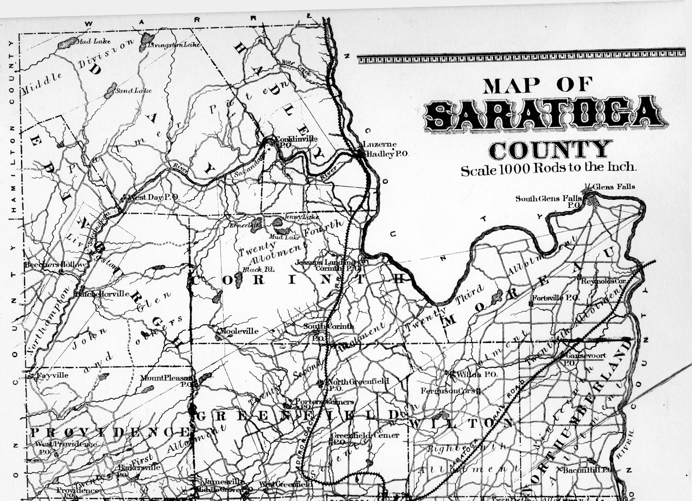
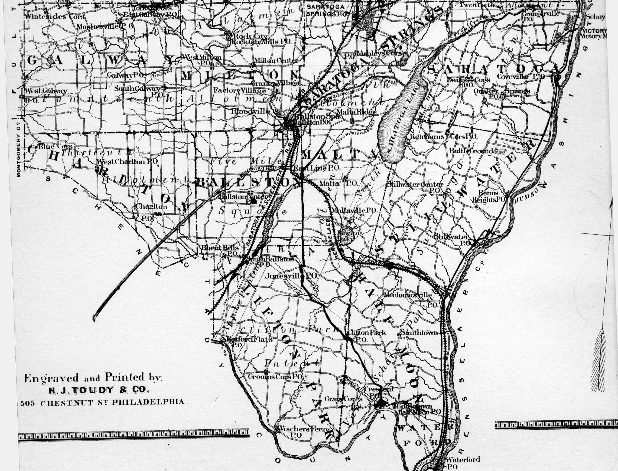
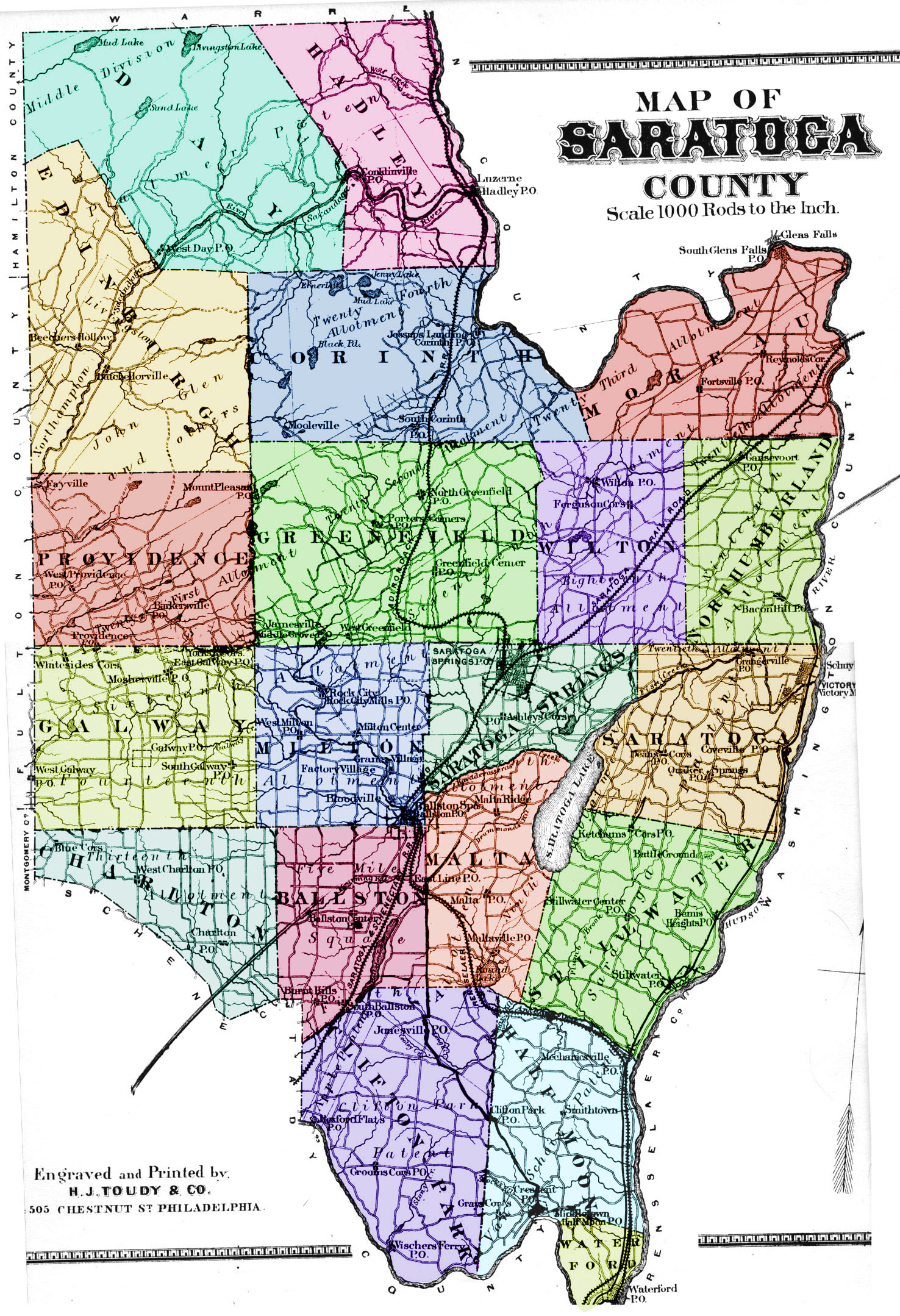
Besides the half-size scan of the map that appears below, included here is a full-size map of the county, and expanded maps of the north half of the county and the south half of the county. Also, I've prepared a full-size color map of the county with different towns shaded different colors.
Unfortuantely, in this edition of the Atlas, there is a major scratch from south-west to north-east running through the middle of the county. (No, that's not a 19th century proposed freeway!)

D. Pane-Joyce
July 2000. All rights reserved
Located at http://aleph0.clarku.edu/~djoyce/gen/saratoga/Atlas.html